The New York Public Library (NYPL) website descriptions of its Image Collections include mentions of several with maps.
 Charting North America: Maps from the Lawrence H. Slaughter Collection and Others
http://digitalgallery.nypl.org/nypldigital/explore/?col_id=149
Maps of North America from the earliest printed portrayals to the close of the 19th century; multiple versions and editions allow for historical comparisons. Early Real Estate Insurance Maps of New York
http://digitalgallery.nypl.org/nypldigital/explore/?col_id=442
Real estate maps of Manhattan and Brooklyn from the 1850s-1860s. Originated by William Perris and commonly called "fire insurance e maps," they show streets, blocks, tax lots, and use classifications plus earlier natural and manmade features. In Motion: The African-American Migration Experience
http://www.inmotionaame.org
SEARCHABLE: A sweeping narrative from the transatlantic slave trade to the Great Migration, from the Western migration to the contemporary immigration of Caribbeans, Haitians, and sub-Saharan Africans. Includes 25,000 pages of texts, rare visual materials, maps, contemporary photojournalism, and lesson plans. NYPL Digital Gallery
http://digitalgallery.nypl.org
Over 600,000 images digitized from The Library's collections including illuminated manuscripts, historical maps, vintage posters, rare prints and photographs, illustrated books, printed ephemera, and more. Picturing America, 1497-1899: Prints, Maps, and Drawings bearing on the New World Discoveries and on the Development of the Territory that is now the United States
http://digitalgallery.nypl.org/nypldigital/explore/?col_id=190
Original prints, drawings, and maps, selected primarily from The Phelps Stokes Collection, featuring views of American towns and cities and representations of historical events, scenes, places, and battles relating to the United States, from 1497 to 1899.
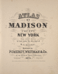
New York State County and City Atlases
The NYPL recently digitized 43 state, county and city atlases covering New York and New Jersey prior to 1900. The NYPL map division has more than 420 titles from this period. I read somewhere on the NYPL website that many of these atlases were in response to the 1876 centennial. I had always assumed it was somehow an outgrowth of the end of the Civil War.
Many of these maps are cadastral in nature. That is, they contain the names of the owners. I imagine most of the cadastral maps for New York that one must pay to see on Ancestry.com can be viewed without charge on the NYPL website.
Detail from a Madison County atlas map showing location of dwellings and names of residents.
See this page for a list of digital holdings from this series. You might prefer viewing the maps with the LizardTech MrSID plugin using Internet Explorer.
No comments:
Post a Comment
Note: Only a member of this blog may post a comment.